According to Google Maps, there’s about 135 miles between Montrose, Colorado (near Black Canyon of the Gunnison National Park) and Cortez, Colorado (near Mesa Verde National Park.) Easy-schmeezy, right? A little over two hours and we can be at our hotel in Cortez—right?
Well…
What Google Maps doesn’t quite mention is that there’s an enormous mountain range in between
Montrose and Cortez. And we would be driving straight through/over those
mountains—on the most frightening road you’ve ever been on.* The name of the
road? US Route 550, or “The Million Dollar Highway” (I have no idea why it’s
called that.)
Mind you, the road isn’t scary because of its condition. It
is, by necessity, very well maintained and smooth. No, the drive was scary
because—for much of the time—there was a several thousand foot drop directly to
our right.
Oh, and there’s no guardrail.
It’s also a breathtaking road which passes through some
of the most gorgeous mountain scenery I’ve ever seen—but it was hard to
concentrate on that aspect while I was keeping my eyes tightly closed and
clutching onto the hand-thing above my seat (because it would protect me if our
car careened off the cliff.)
-
But let’s back up.
After we left Black Canyon, we began heading into some
really beautiful country. As you drive south of Montrose, you begin approaching
the San Juan Mountains—which is one of the most beautiful ranges I’ve ever
seen. Telluride, home of a famous ski resort and film festival, is located in
these mountains (we decided not to take the Telluride route through the
mountains because of construction—I wonder now if it would have been less
harrowing.) Unfortunately, I don’t have many pictures of this part of the
drive. It’s hard to take pictures with your eyes closed—so I’m going to take
some from Google and Wikipedia.
Anyways, we keep driving, and the mountains keep getting
closer, and we begin to realize that we we're almost certainly going to end up
driving through or over those rather tall and imposing peaks.
And, right at the foot of the mountains, we reach the really gorgeous town of Ouray and admire the
scenery.
 |
| Ouray, Colorado. This is not my picture. |
And then we pass through Ouray, and the road keeps going up.
And up. And up. And then we’re at an overlook a thousand or more feet above
Ouray. And we keep going up. And up. And up.
And the mountains are green and lush, with lots of waterfalls—but I don’t really notice, because we keep going up. And up. And up.
And there’s no guardrail. And, about two feet to our right,
is a 2,000 foot drop. Into an abyss.
And the road is narrow, and the speed limit strangely high,
and every time a car passes us you feel a little bit… Tense.
And still we go up, and up, and up. And up.
Ouray, Colorado is located at 7,700 feet above sea level.
Within an hour of leaving Ouray, we were driving over mountain passes at 11,000
feet.
There were a lot of passes on this drive. So we’d go up a
few thousand feet, and then down a few thousand feet, and then back up a few
thousand feet, and… It was a very long (and not fuel efficient) two or three
hours.
 |
| Not my photo |
 |
| Not my photo either |
Fortunately, the first hour outside of Ouray was the worst.
After that, the cliffs weren’t quite as high or steep and we could finally breathe.
Our biggest concern, at that point, was getting out of the mountains before
sunset (we intentionally left Montrose early enough to make sure we would get
to
Cortez by sunset. But we had failed to take the mountains into account.)
 |
| When we drove under this "avalanche chute," there was a pretty good waterfall running over it. In other words, we drove under a waterfall. (Not my photo) |
 |
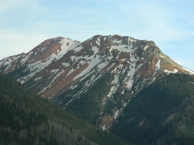
| The appropriately named "Red Mountain" |
But we did - finally - roll into Durango just as the sun was setting.
From there, it was a relatively easy hour to Cortez—where we checked into our
hotel and had dreams about falling off cliffs (ok, maybe that was just me.)
Addendum
I found out later that many people love driving the Million
Dollar Highway—which I can understand, since it is very pretty and it
apparently has a ton of really amazing ATV trails leading off of it, etc.—but
they always recommend driving north from
Durango, instead of south from Ouray. That way, you’ll be hugging the
mountainside through much of the drive, rather than driving two feet away from
the edge of a cliff. Which, I imagine, is considerably less stressful.
“If only we had known,” etc.
A Truly Random Side Note
Incidentally—and this may only be interesting to me—it turns
out that about 50 miles west (as the crow flies) of where we were driving in
the San Juan Mountains sits the La Garita Caldera—the site of one of the
largest volcanic explosions in the history of the world. It was several times
bigger than the much-ballyhooed Yellowstone supervolcano. For some reason, I
find that kind of thing cool—even if it was 25 million years ago. I'd love to visit the site of the eruption one day when I have access to an ATV.
-
*Ok, so it's quite possible that you've been on more terrifying roads - I mean, at least this one was paved and well-maintained. It was really only terrifying because of the steep, steep dropoffs and the lack of guardrails (and the narrow lanes, and the speed limits, and...)


